


Nestled in the heart of Jakarta’s Kota Tua (Old Town), the Kali Besar river stands as a living testament to the city’s rich and layered history. For centuries, this historic canal has witnessed the rise and fall of ancient Hindu kingdoms, the height of Dutch colonial trade, and the city’s ongoing modern revitalisation efforts.
Kali Besar, meaning “Big River,” is the straightened and canalised lower section of the Ciliwung River in northwestern Java. The Ciliwung itself stretches 119 kilometres, originating in the lush highlands near Puncak in Bogor, flowing through Depok and Jakarta, before emptying into Jakarta Bay at the ancient port of Sunda Kelapa. The river basin has been inhabited since at least the 4th century CE. Its name likely derives from the Sundanese words ci (water) and haliwung (turbid or murky). Flowing through this strategically vital location, the Ciliwung naturally provided fresh water and served as a transportation route long before it was reshaped by Dutch engineers. In this article, Sake Santema from Indies Gallery shares a brief history of the iconic waterway, illustrated with antiques from his collection.
Pre-Colonial and Early VOC Foundations
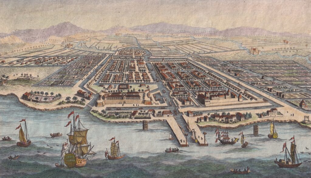
In the 15th century, the port of Kali Besar, known as Sunda Kelapa, served as a vital port for the Hindu Kingdom of Pajajaran (also known as the Sunda Kingdom), facilitating trade in spices, rice, and other goods with regional powers. One of the longest-lasting kingdoms in western Java, Pajajaran existed from around 669 CE to 1579 CE. At its height, it encompassed much of present-day Banten, Jakarta, West Java, and parts of western Central Java, with occasional influence extending to Lampung, South Sumatra. From 1482 onward, its fortified capital at Pakuan Pajajaran, strategically situated between the Ciliwung and Cisadane rivers, gave the kingdom its popular name.
In 1527, the port of Sunda Kelapa was conquered by Fatahillah, was renamed Jayakarta, meaning “victorious”, and became the first Muslim state in Java. Under the rule of the Banten Sultanate, Jayakarta flourished as an important trading hub, particularly for pepper, though it remained secondary to Banten’s main capital 80km west. Control was never absolute, as tensions frequently arose with Portuguese, Dutch, and English traders. This era came to an end in 1619, when the Dutch East India Company (VOC), led by Jan Pieterszoon Coen, attacked and razed Jayakarta during conflicts over trade. The Dutch expelled the Bantenese authority, rebuilt the city as Batavia, and established it as the headquarters of their operations in the East Indies.
The Rise and Fall of Kali Besar
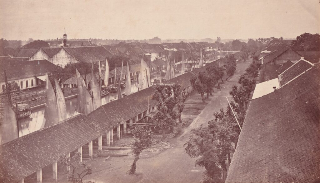
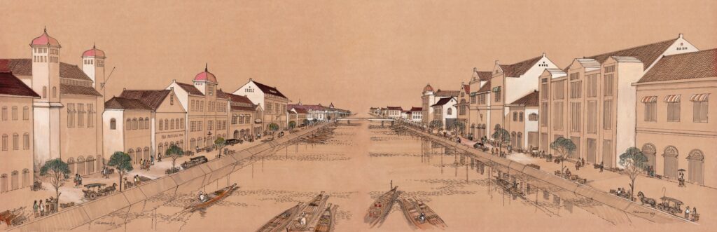
In the early 1630s, the Dutch recognised the Ciliwung River’s strategic value and set their engineers to work. They straightened and widened the lower stretch into an efficient canal, creating the streets that would become Jalan Kali Besar Barat and Timur. Soon, deep-draft ships and barges could glide far into the heart of Batavia. During the 17th and 18th centuries, Kali Besar became the vibrant commercial heart of Batavia and one of Asia’s most important ports. Warehouses, shipyards, merchant offices, and elegant mansions lined its banks. Vessels unloaded spices, textiles, and porcelain from across Asia, while local perahu boats and European ships filled the canal with constant activity. The area, often compared to Amsterdam, was cosmopolitan and prosperous. Wealthy merchants, especially Chinese traders who were vital to the economy, built fine residences along the water. Nearby shipyards rang with hammers and saws.
Yet beneath the prosperity lay hardship. The canal depended on forced labour, and poor sanitation bred deadly outbreaks of malaria and other diseases. By the late 18th century, as the VOC declined, Kali Besar began to lose its importance. In the 19th century, the city expanded southward toward the healthier district of Weltevreden, nowadays Menteng. The city’s elite drifted away, leaving the canal to silt up, fill with pollution, and slip into neglect. The opening of the modern Tanjung Priok port in 1885, just ten kilometres away, further displaced its role as a trading centre of the city. For decades afterwards, Kali Besar faded into the background—a quiet relic of the city’s rich history, largely forgotten but still carrying the echoes of its once-thriving past.
A New Chapter
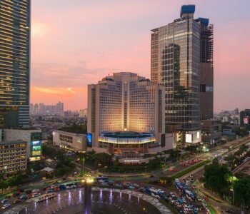
Today, Kali Besar is a key part of the Kota Tua heritage area. Revitalisation efforts since 2016 restored its appeal with cleaned waterways, pedestrian zones, warehouses, and the Kota Intan Drawbridge. These form a part of efforts to make Kota Tua a UNESCO World Heritage site, showcasing 17th-century Dutch colonial planning. Kali Besar stands as a living testament to Jakarta’s layered history — from indigenous trading roots through colonial global commerce to contemporary heritage preservation. Its waters, though quieter now, continue to tell stories of trade, cultural mixing, and resilience that shaped one of Southeast Asia’s great metropolises.
The prints in this article are available for purchase through Indies Gallery, while high-quality reprints can be found at Old East Indies.
Indies Gallery & Old East Indies
Jl. Gambuh No.17, Denpasar, Bali
www.indiesgallery.com
www.oldeastindies.com
Enjoy reading about old prints and photographs? Read Santema’s other articles below:
The Origins, History, and Significance of Keris in Indonesia
Bathing in Indonesia In Early Prints and Photographs
Bali Island in Early Photography