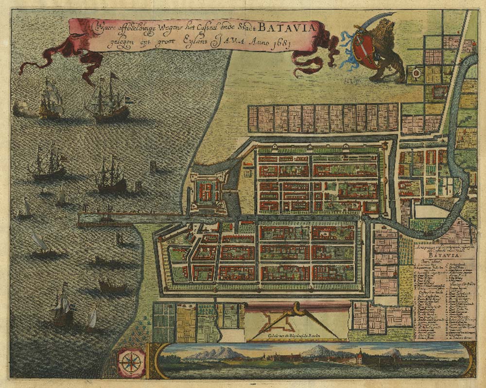
City Plan of Batavia (Jakarta) by Gregorio Leti (1681) – courtesy of Indies Gallery
This large size map of Batavia, was published in Amsterdam in the year 1681, it shows the old Dutch Capital City on Java with a bird’s eye view, decorated with ships and a view of the city from the sea
All data and history point to the area of Kota, on the west bank of the Ciliwung River approximately eight hundred meters south of the Pasar Ikan. There, the seeds were planted that developed into the metropolitan city of Jakarta Raya, one might say the birth of Jakarta, a city which is now home to more than 11 million people.
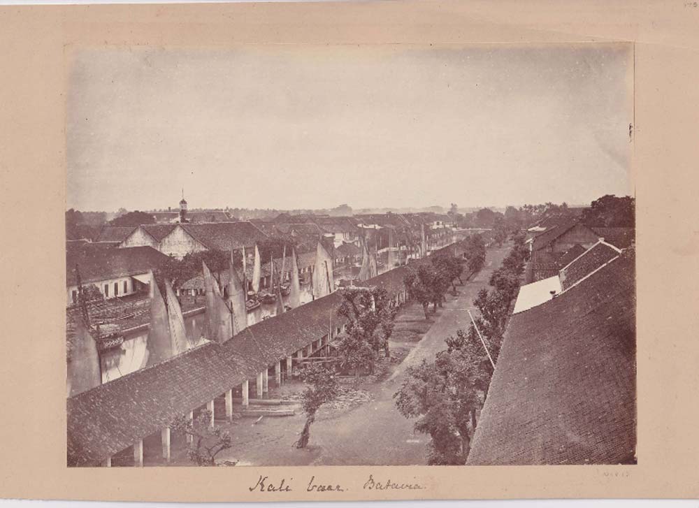
When did the history of Jakarta begin? Nobody knows for sure. But, if we stand at the top of the Menara Syahbandar to the west of the bridge over Kali Besar, we can enjoy views of Jakarta’s oldest area. To the north, we can see the scene of Sunda Kelapa harbour with many traditional colourful sailboats lined up, creating a charming sight to see. This harbour was once the city’s lifeblood — and its origins.
Sunda Kelapa became the main port of the Hindu Pajajaran Kingdom, its capital was Pakuan Pajajaran, which was once located in Batutulis (Bogor) and at that time could be reached on a two-day journey up the Ciliwung River. This harbour was visited by ships from Madura, Palembang, Tanjungpura, Malacca, and Makassar, even by traders from India, South China, the Ryu-Kyu Islands (Japan), and Europe to get spices, especially pepper dan nutmeg which was the Kingdom’s main commodity. From this harbour, pepper, nutmeg, rice, and gold – the ‘riches’ of Indonesia – were exported.

Batavia (Jakarta) City View by Jan Van Ryne (1793) – courtesy of Indies Gallery
This print made circe 1793, shows “The city of Batavia in the Island of Java and Capital of all the Dutch Factories & Settlements in the East Indies” (original title of Van Ryne’s piece),
The existence of Sunda Kelapa harbour was believed to have appeared in the 4th century during the Tarumanagara Kingdom. This was based on the Tugu records and inscriptions which contain excavations of two rivers, namely Candrabhāga and Gomati. The Candrabhāga River was dug first so that its waters flowed into the sea and past the illustrious royal palace of Pūrṇawarman. Meanwhile, the excavation of the Gomati River was carried out in the 22nd year of Pūrṇawarman’s reign and was completed in 21 days.
Meanwhile, Portuguese sources can be obtained from Tome Pires’ travel reports contained in his monumental work entitled Suma Oriental. In 1513, Pires arrived on the island of Java, then he walked along the north coast of Java and stopped at several ports, including Sunda Kelapa, referred to as Capala in his book. At that time the Hindu Pajajaran Kingdom had six seaports, namely: Bamtam (Banten), Pomdam (Pontang), Chegujde (Cigede), Tamgaram (Tangerang), Capala (Kalapa), and Chemano (Cimanuk). Among the six ports, Sunda Kelapa was the main harbour.
In 1513, four Portuguese ships under the command of de Avin visited the harbour. They came from Malacca and looked for spices, especially cloves, pepper, and nutmeg. Pires, who visited Sunda Kelapa that year, said as an eyewitness that the port was busy and well-managed. Several years later another Portuguese, Enrique Leme visited Sunda Kelapa with various gifts for the King of Sunda Samiam or Sanginag (Portuguese pronunciation for Sang Hyang), namely King Surawisesa (1521-1535).

Leme was well received on 21 August 1522, and a treaty of friendship between the Kingdom of Sunda and the Kingdom of Portugal was established. This is the first international agreement in Indonesia. As a sign of the agreement, a large stone was planted on the beach as a memorial to the agreement. The stone, Padrao, was rediscovered in 1918, when excavations were being made for a new house at the corner of Jalan Cengkeh and Jalan Nelayan Timur. The stone is now kept in the National Museum. The location of the stone found points to the fact that the coast at the beginning of the 16th century was straight with the line south of the railroad tracks and the Tanjung Priok-Cengkareng elevated toll road, about four hundred meters south of the Menara Syahbandar. Thus, the entire area to the north, even where the Menara Syahbandar was at the beginning of the 16th century, was still a shallow sea.
This good relationship resulted in the Portuguese being allowed to set up trading offices around the harbour. The Sultanate of Demak, which saw the relationship between the Portuguese and the Kingdom of Sunda as a threat, then planned an attack on Sunda Kelapa.
On 22 June 1527, the joint forces of the Demak-Cirebon Sultanate under the leadership of Fatahillah attacked and managed to control Sunda Kelapa. According to some historians, this victory was the reason for renaming Sunda Kelapa to Jayakarta, which means ‘great victory’. Based on the theory of Dr. Soekanto, Governor Sudiro set the city’s birthday celebration on 22 June (1527), because Fatahillah had won and gave Sunda Kelapa its new name. This is the date we use today to celebrate the birthday of the City of Jakarta.
While attending the first celebration of Jakarta’s birthday in 1956, Prime Minister Ali Sastroamidjojo was astonished and half mocked this ‘odd anniversary’. Prof. Dr. Slamet Muljana was of the opinion that there was no data whatsoever regarding the name change from Sunda Kelapa to Jayakarta. He proposed the theory that this city got a new name from the third duke, Prince Jayawikarta or Wijayakarta. This hypothesis did not match reality either because the name ‘Jakarta’ has appeared since the 1560s — though in a slightly different spelling.
The name appears for the first time in Joao de Barros’ book, Da Asia…, IV, 1, 12: Xacatara por outro name caravam. ‘Xacatara which is also called Caravam’ (Karawang). This manuscript was published in 1615 but was compiled in the mid-1560s. Hence, it can be concluded that the name Ja(ya)karta was used since at least this period and that the birth of Jakarta is best attributed to this. Whilst evidence shows that the Portuguese in Malacca who traded in Banten and Sunda Kelapa since 1532 referred to the port city as such.
Under Dutch rule, Sunda Kelapa harbour was renovated. Originally, the harbour which previously only had a 810 m long canal, was enlarged to 1,825 m. Starting in the 19th century, the harbour began to be filled with silt, seeing fewer and fewer ships anchor there. This was a shame, as the Suez Canal had just opened and this would have been a great opportunity for the port (and thus trade) to grow.
Seeing that the historical harbour was draining this potential, the Dutch looked for a new place to develop a new port: Tanjung Priok. This became the largest harbour in Indonesia, and Sunda Kelapa fell into quiet obscurity, despite its importance in bring out the birth of Jakarta.
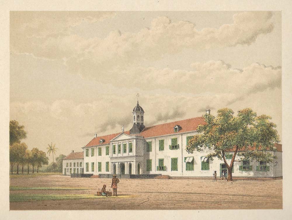
Antique chromolithograph of the iconic Stadhuis of Batavia which served as the city hall for Batavia from 1627 until 1913. The building was declared a cultural heritage site in 1970, becoming the Jakarta History Museum.
Today, Sunda Kelapa harbour doesn’t look as busy as it did in its heyday. Now it services inter-island ships in Indonesia. However, considering it has a high historical value, this harbour has been converted into a historical site. Dutch heritage buildings around the harbour area are now used as museums, such as the Maritime Museum (Museum Bahari), Fatahillah Museum, Puppet Museum etc.
Near the Museum Bahari, which is located at Jalan Pasar Ikan No. 1, North Jakarta, there are remnants of the Batavian city boundary wall. This is the last piece of the long wall of the city of Batavia built by the Verenigde Oost-Indische Compagnie (VOC) trading company. This wall is connected to the Culemborg bastion which is in the Menara Syahbandar complex. The Bahari Museum, which was built in three stages from 1652-1771, used to be a spice warehouse as well as the boundary wall of the city of Batavia. These buildings are part of the oldest buildings in Jakarta which became the forerunner of the city of Jakarta.
Historical References: from the book of “Tempat-Tempat Bersejarah Jakarta” by A. Heuken SJ.
The images shown in this article are offered for purchase by Indies Gallery, dealer in authentic maps, prints, books and photographs, dating from the fifteenth to the twentieth century: www.indiesgallery.com.
Indies Gallery also offers these decorative artworks as reprints. You will find these at www.oldeastindies.com