



Beyond their white-sand beaches, coral reefs, and tranquil seaside resorts, Kepulauan Seribu (the Thousand Islands) offers fascinating island-hopping experiences steeped in heritage and history. Since the early 17th century, they have served as buffer zones and defensive outposts for the Dutch East India Company (VOC) and later, the Dutch colonial administration. Today, these historical remains are scattered across the islands, providing visitors with a glimpse into Indonesia’s maritime past and the natural beauty of Jakarta’s offshore islands.
The Thousand Islands Regency lies in the waters of Jakarta Bay, framed by two headlands: Tanjung Pasir to the west and Tanjung Karawang to the east. At the southern end of the archipelago are 10 small islands, including Rambut, Untung Jawa, Onrust, Kelor, Cipir, and Bidadari. From the VOC era through to the Dutch colonial period, these played a strategic role in protecting Batavia (Jakarta), as defensive fortresses, quarantine facilities, warehouses, and shipping hubs.
Today, many of the islands have been transformed into tourist destinations. Ayer and Bidadari have become popular resort retreats, while Untung Jawa remains the only permanently inhabited island in the southern cluster.
NOW! Jakarta joined a team from the Jakarta Maritime Museum Management Unit on a visit to the Thousand Islands in preparation for Jakarta’s 500th anniversary next year. Celebrations will focus on preserving and promoting the city’s maritime heritage, as well as creating relevant programmes.Departing from Kamal Muara Jetty in North Jakarta, we boarded a Museum Bahari boat accompanied by Mis’Ari, the Head of the Maritime Museum Management Unit. We crossed Jakarta Bay, retracing centuries of history as we journeyed towards Kelor, Cipir, and Onrust islands.
These historic islands are among the heritage sites managed by the Maritime Museum Management Unit, alongside Museum Bahari, Menara Syahbandar, Jembatan Kota Intan, Rumah Si Pitung, and the Marunda Historical Site.
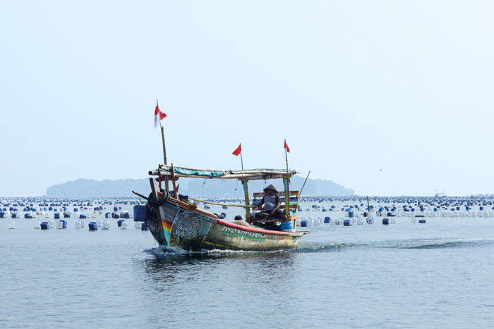
We passed the fishing settlements of Kamal Muara and Dadap, where colourful vessels lined the waterfront. Twenty minutes later, we arrived at our first destination: Kelor Island.
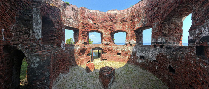
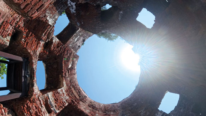
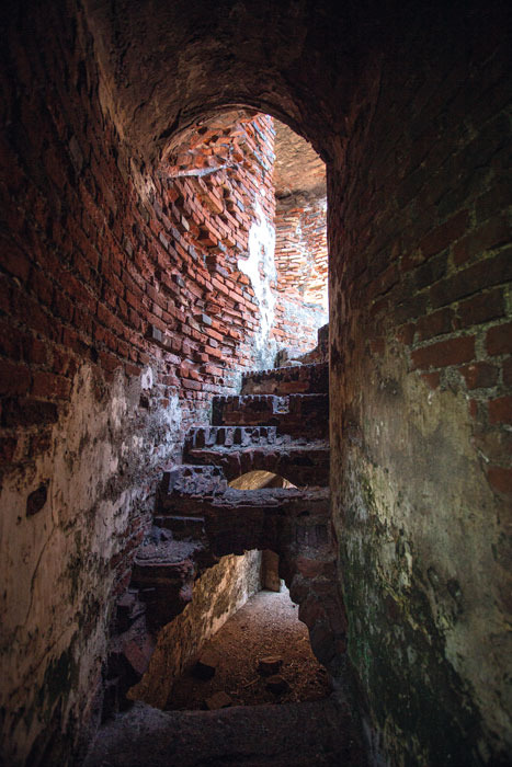
(Above) Inside the Martello Fortress, visitors can see the historic fort still standing strong despite the passage of time; (Below-Left) Sunlight streams into the Martello fortress which stands approximately 9 metres above sea level; (Below-Right) The staircases inside the Martello fortress are spiral brick structures, designed to connect the ground floor to the rooftop platform. In its military days, the roof served as a cannon emplacement, allowing defenders to monitor and protect the surrounding waters. Photos by Des Syafrizal.
Kelor Island is relatively small and, due to coastal erosion over the centuries, now spans just 1.5 hectares. It was known as Kerkhof Eiland during the Dutch colonial era, meaning “graveyard island”. Despite its name, however, no evidence of graves or burial sites has ever been discovered there.
The island is instantly recognisable by its distinctive Martello fortress. Although historians continue to debate whether it was directly inspired by the original Martello fortifications developed along the coast of Corsica, France, similar defensive structures can be found elsewhere in Indonesia. Similar towers were also built on Onrust, Cipir, and Bidadari Islands, as well as at Karang Trigoson and Karang Mathilda, both of which have since disappeared beneath the sea. They formed part of a wider maritime defence network established during the 19th century
Constructed in 1850, the fortress on Kelor Island is a circular, barrel-shaped structure built primarily from red brick. Measuring approximately 14 metres in diameter, its walls are an impressive 2.6 m thick. Despite its formidable appearance, the tower served its original defensive purpose for fewer than 20 years. By 1871, it had been converted into an ammunition store for the Dutch East Indies fleet.
Its military significance gradually declined, and by the early 20th century, it had largely fallen into disuse. A newspaper article titled “Verlaten Eilanden” (Abandoned Islands), published in 1905, described the fortification as neglected and deteriorating. Much of the damage is believed to have resulted from the catastrophic eruption of Krakatoa in 1883, which triggered a tsunami and shockwaves that devastated coastlines across the region.
Any vessel entering the bay from the north would first encounter Kelor, making it a crucial first line of defence.
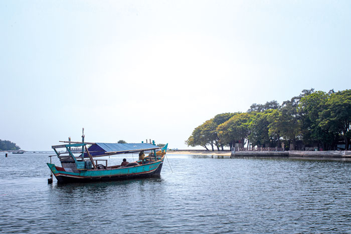
From Kelor, we continued to Cipir Island, also known as Kahyangan Island (Dutch: Kuiper Eiland), which appears on 18th- and 18th-century maps as a European settlement and played an important role in the VOC’s operations.
During the company’s heyday, Cipir served as a storage and logistics centre. One of the most vivid records of this period appears in a 1769 painting by Johannes Rach, depicting the VOC merchant vessel Vreedenlust undergoing repairs. The scene portrays enslaved labourers hauling the ship upright under the supervision of a foreman carrying a whip—a stark reminder of the human cost behind colonial trade.
Between 1850 and 1853, a Martello fortress was constructed on the island. However, its military role proved short-lived, and the structure was later converted into a warehouse. Towards the end of the 19th century, much of the fort was demolished to make way for facilities serving an entirely different purpose: quarantine.
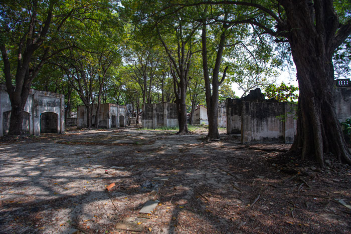
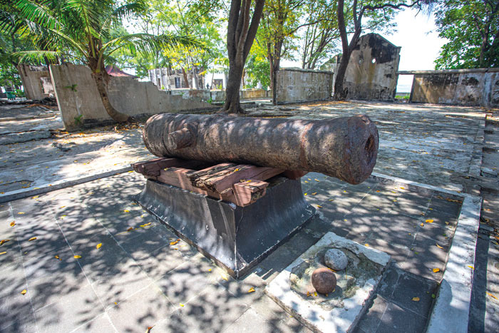
(Left) Quarantine facilites buildings in Cipir island; (Right) A cannon stands amid the ruins of a former hospital and isolation acentre on Cipir Island. Photos by Des Syafrizal.
Along with neighbouring Onrust Island, Cipir became an important public health station. Construction of quarantine facilities began in 1911, and by the following year, they were operational. The island accommodated travellers affected by infectious diseases and later became closely associated with the Hajj pilgrimage.
As healthcare facilities on the mainland improved, the island’s importance gradually diminished. By 1958, the quarantine complex had fallen into disuse and was eventually abandoned. Many of the former hospital buildings were dismantled, with residents salvaging bricks and timber for use in nearby settlements.
Our final destination was Onrust Island, historically the busiest and most important of the islands in Jakarta Bay. Its name derives from the Dutch word onrust, meaning “restless” or “unceasing activity”, reflecting its long-standing role as a centre of maritime commerce and naval operations.
Strategically located just north of Batavia, Onrust became one of the VOC’s most important island bases. The constant movement of ships, goods, and workers transformed it into a bustling hub supporting vessels travelling throughout Asia and Europe.
In his book Onrust dan Sekitarnya: Gugusan Pulau Bersejarah di Teluk Jakarta (Onrust and Surroundings: A Historic Island Cluster in Jakarta Bay), archaeologist Candrian Attahiyyat explains that the origins of Dutch colonial rule in Indonesia can be traced directly to Onrust Island. Its strategic location made it an ideal base from which the VOC could establish control over Jayakarta (before the city was called Batavia).
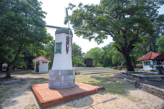
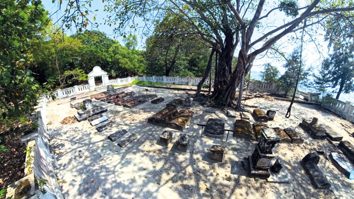
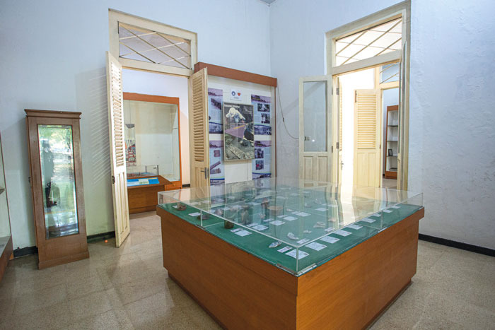
(Above) Replica windmills greet visitors as they arrive at the pier on Onrust Island; (Below-Left) A Dutch cemetery on Onrust Island, where weathered gravestones bear witness to the lives and deaths of colonial-era residents, many of whom succumbed to tropical diseases far from home; (Below-Right) The atmosphere inside the Onrust Archaeological Museum offers a glimpse into the island’s rich past, with historical artefacts, archaeological finds, and exhibits that trace its role as a strategic maritime hub through the centuries. Photos by Des Syafrizal).
Beginning in the mid-17th century, warehouses, staff housing, and shipyard facilities were constructed on the island. A fort followed in 1656 and was repeatedly expanded in response to attacks from rival powers. By the 18th century, Onrust featured extensive military and civilian infrastructure, including hospitals, churches, residential buildings, and a windmill.
European conflicts eventually reached the waters of Jakarta Bay. British forces attacked and burned parts of the island during the late 18th and early 19th centuries before occupying the area until 1816. Following the restoration of Dutch control, Onrust resumed its maritime functions. In 1911, it was designated as a quarantine station for Hajj pilgrims and patients suffering from infectious diseases.
The ruins of the former facility remain clearly visible today. At its peak, the island housed 35 barracks, each capable of accommodating up to 100 Hajj pilgrims. In 1933, Hajj quarantine operations were relocated to Tanjung Priok Port.
A Dutch cemetery remains on the island. Of the approximately 52 graves there, most belong to Dutch settlers and officials who died at a young age, often as a result of tropical diseases. Historians believe that Onrust was far from a healthy place to live, with disease posing a constant threat.
To learn more about the island and its surrounding heritage sites, visitors can explore the Onrust Archaeological Museum, housed in a former doctor’s residence opposite the ruins of the old barracks and hospital. The museum offers insights into the island’s history through informative displays, a scale model of Onrust Island, and interactive exhibits that bring its colonial and maritime past to life.
The museum’s collection includes 394 archaeological artefacts recovered from Onrust and the neighbouring islands. Among the most notable are ceramics and pottery fragments dating from China’s 19th-century Qing Dynasty, providing evidence of the maritime trade networks and cultural exchanges that once linked Batavia with the wider Asian region.
Getting there:
Besides Kamal Muara, many travellers depart from Muara Angke pier, known for its affordable public boat services, while Marina Ancol offers a wider range of tourist ferries and private charters.
Traditional boat rental/speedboat rental: Around IDR 350,000 to IDR 1,000,000 per boat (depending on the pier of origin such as Marina Ancol or Muara Kamal and the type of boat).
Local Government Tourist Boat (Kapal Wisata Pemda): Tickets cost IDR 49,000 per person for the round-trip route (crossing Muara Angke-Cipir-Onrust-Kelor).
Many tour operators offer open trip packages at more affordable prices. An Open Trip covering three islands ranges from IDR 120,000 to IDR 175,000 per person, and includes the ferry ride, entrance ticket, and guide.