During the Dutch East Indies era, Kebayoran was a vast district with a long and evolving history. Today, it has grown into two distinct areas: Kebayoran Lama and Kebayoran Baru. Though geographically close, each carries its own character. Kebayoran Lama retains a strong traditional and local atmosphere, while Kebayoran Baru embodies modern living and dynamic urban development. Together, they shape the diverse identity of South Jakarta, offering a destination rich in heritage, culture, and varied lifestyle experiences.
Kebayoran was originally a village known as Kampong Kebajoran, straddling the banks of the Grogol and Pesanggrahan rivers. Far from isolated, it sat strategically along the main road and trade route connecting Buitenzorg (Bogor) and Tanah Abang, just south of Batavia. At that time, Kebayoran was also under Afdeeling Meester Cornelis, along with Meester Cornelis (now Jatinegara), Bekasi, and Cikarang. Afdeeling is the same level with regency.
In 1854, Residentie Batavia (now Jakarta) was only two afdeelings: Batavia and Meester Cornelis. Then in the 1890s, there were five afdeelings: Batavia, Meester Cornelis, Buitenzorg, Karawang, and Tangerang. As one of the settlements within this structure, Kebayoran played a small yet meaningful role in the administrative and economic landscape of the Dutch East Indies.
There are two historical interpretations regarding the origin of the name Kebayoran. The first, which is most popular, follows a common pattern in Jakarta, where place names often come from local plants or trees. In this version, Kebayoran derives from bayur, a type of monocotyledonous plant resembling a palm, often associated with the coconut tree. The second interpretation links the name to the Dutch word baljuw (balyuw), meaning bailiff, court, or customs (tax collector). This version is tied to Kebayoran’s past as an important district within the Afdeeling Meester Cornelis.
Kebayoran’s name did not appear explicitly on 18th-century maps. Even in maps from the 1840s it remained absent, while nearby areas such as Pengumben, Pondok Betung, and Ulujami were already documented. It wasn’t until 1953 that Kebayoran began appearing on maps, and by 1883, it had become a significant and well-documented area, with a Dutch controller assigned as the deputy of the Assistant Resident of Meester Cornelis.
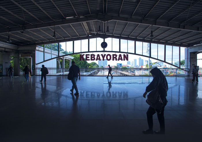
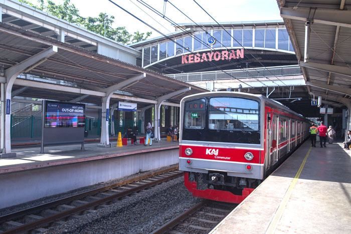
The area’s importance grew with the arrival of the railway. A station was built in 1899 as part of the Tanah Abang–Rangkasbitung (Banten) line constructed by Staatsspoorwegen (SS). This development strengthened Kebayoran’s position, and in 1905 its status was elevated to district level. The station, located in Kebayoran Lama, the capital of the Kebayoran District, was originally named Kebayoran Lama Station before being renamed Kebayoran Station in 2016.

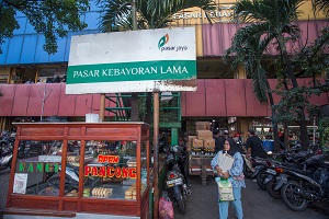
After Kebayoran’s status was elevated to a district, key economic infrastructure, most notably a market, was developed around the district center. The present location of Kebayoran market lies west of the station. Unfortunately, this historic structure was demolished and replaced with a new building in 1987. Today, although the market is in a deteriorated condition, it remains lively and continues to sustain a dynamic local economy.
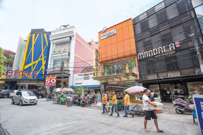
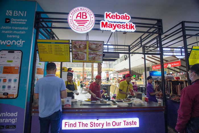
During the early development of Kebayoran, Pasar Mayestik was also established. Interestingly, the site originally functioned as a cinema. In 1981, the cinema was demolished, and in 2010 the area was redeveloped into a modern four-story market. Pasar Mayestik has a unique layout, with rows of shops built around the former cinema structure. Today, while it still offers food and clothing, the market is especially known as a popular destination for textiles, tailoring materials, and a variety of culinary options. On one side of its entrance gate stands a Khong Guan Mart, representing the iconic Indonesian biscuit brand. Previously, this biscuit depot was only in Pasar Mayestik and Menteng.
Another historical landmark in Kebayoran Lama is the Radio Republik Indonesia (RRI) II Transmitter building located in Radio Dalam. The Dutch government built this transmitter due to the site’s elevated and concealed position, as well as its administrative convenience. It served as a complement to the existing transmitter at the foot of Mount Malabar in Bandung. In fact, the radio waves received at Radio Dalam were even stronger than those captured at Malabar. On 22 December 2019, the RRI transmitter tower in Radio Dalam collapsed due to strong winds. Rather than rebuilding it at the original site, the tower was relocated to Cimanggis, West Java.
After Indonesian independence, the Dutch colonial administration still attempted to regain control and planned several new settlements as part of Jakarta’s post-war urban expansion. At that time, the capital was becoming increasingly crowded, particularly in the 1940s. The earliest plan, drafted in 1946, proposed a residential area in Gandaria for employees of the Batavia Petroleum Maatschappij (BPM).
When discussions about establishing a new settlement in Jakarta progressed, the municipal government formed the Centrale Stichting Wederopbouw (CSW). In 1948, the foundation stone for the new residential district in Kebayoran Baru was laid. The development aligned with the emerging concept of a satellite city, an independent urban area equipped with complete facilities and proper housing, designed to serve as a buffer for central Jakarta.
The landscape development of Kebayoran Baru was completed in 1955 and was later expanded with small-scale housing intended for civil servants. CSW was headed by Mohammad Soesilo, a former student of the influential architect and urban planner, Thomas Karsten. Soesilo designed both the architectural layout and the landscape of the area, drawing inspiration from the elite Menteng district. However, the building architecture adopted a new and distinct post-independence style known as jengki architecture.
Jengki, a modern Indonesian architectural style, emerged as a development of art deco blended with local architectural principles, particularly those suited to the tropical climate. It is easily recognised through distinctive façade features, such as asymmetrical roofs with steep slopes designed to improve rainwater runoff, as well as upward-angled pentagonal wall shapes that help block direct sunlight.
The rise of the Jengki style was also driven by political motivations. In the early post-independence period, architectural design was encouraged to break away from colonial aesthetics. Examples of Jengki-style houses in Kebayoran Baru can still be seen in the former BPM housing complex on Jalan Pakubuwono VI.
The new settlement area of Kebayoran Baru initially covered approximately 730 hectares, before later expanding to 1,291 hectares. Soesilo’s masterplan adopted the garden city concept, emphasising green open spaces and human-centered planning to support sustainability and create an environment-friendly, livable urban district.
Soesilo also envisioned Kebayoran Baru as a socially mixed and heterogeneous community, offering a variety of housing types arranged in an orderly manner. The district was systematically divided into blocks (‘blok’) based on building functions, with each block labeled alphabetically, from Blok A to Blok S, and separated by roads and generous green spaces.
In the early phase of development, Blok E (Taman Pakubuwono) was the first to be built. Today a high-end commercial area, Blok E was later expanded eastward and southward in alignment with the pattern of modern public transportation in Jakarta. Several blocks were designated as residential neighborhoods, parks, economic centers such as shops and markets, and offices.
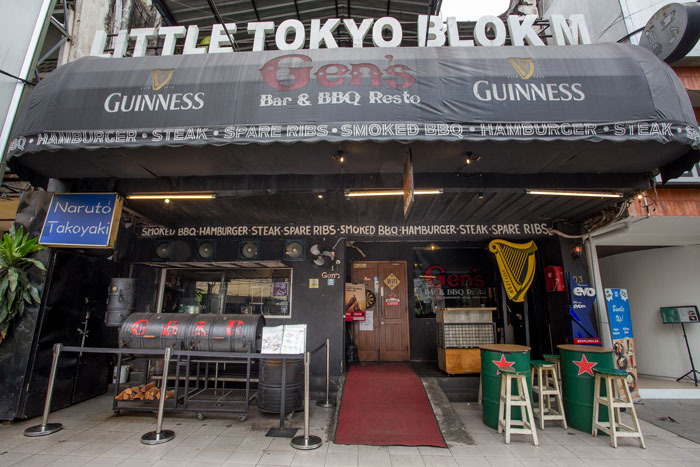
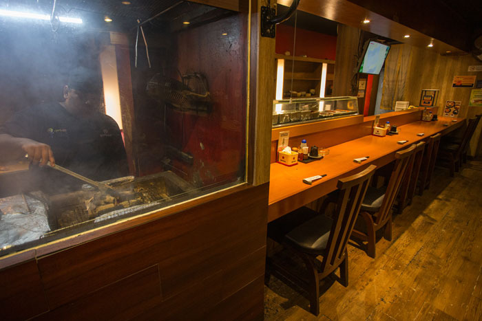
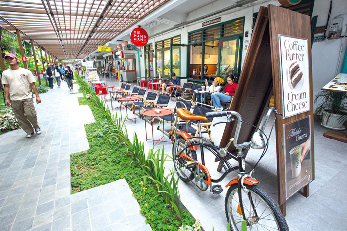
One of the many Japanese restaurants in Melawai that gives the area its “Little Tokyo” charm (above); Kira Kira Ginza restaurant, was one of the oldest Japanese establishments to open in the neighborhood (left); M Bloc Space, a place you need to visit to experience the creative and dynamic atmosphere in the middle of Jakarta. Photos by Des Syafrizal.
Today, many of the original 19 blocks have been consolidated into modern administrative sub-districts. For example, Blok B, C, and D now form the Kramat Pela sub-district, while Blok M and N have become the Melawai sub-district.
Located around Melawai, Blok M remains one of the most vibrant areas in Kebayoran Baru. The Blok M Shopping Center, whose construction began in 1974 and was completed in 1977, became the catalyst for the area’s growth. This was later followed by the development of Blok M Square and Pasaraya Blok M, both integrated with the Blok M transportation terminal. As a result, people no longer relied solely on Pasar Baru, Pasar Senen, or Glodok when searching for goods.
A neat row of shops soon developed around Melawai, enriched by the emergence of a distinctive Japanese enclave that made the area feel like a small “Little Tokyo”. In mid-1985, the Kira Kira Ginza restaurant was one of the oldest Japanese establishments to open in the neighborhood. Its presence sparked the growth of other Japanese-style restaurants, and by the early 1990s Melawai had taken on an increasingly Japanese-inspired character.

Blok M has also long been appealing as a chosen hangout spot, for young people and visitors of all ages. Beyond the continual arrival of new shops, restaurants, and cafés competing to offer the latest experiences, Blok M has also undergone major improvements through the integration of modern public transportation. With TransJakarta, the MRT, Mikrotrans, and other modes now seamlessly connected, residents can access a wide range of city amenities more easily than ever before.
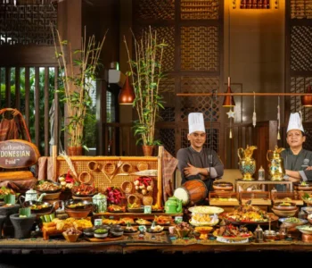
In Jakarta’s urban development, much of the activity is concentrated in Kebayoran Baru, not only as a hub for shopping, services, and offices, but also as a destination that invites visitors to explore its every corner. When it comes to lifestyle and dining, Kebayoran Baru also offers far numerous upscale restaurants spread across Gandaria, Pakubuwono, Senopati, Gunawarman, and Panglima Polim.
Significant improvements in infrastructure and public facilities have made Kebayoran Baru, which is already in a strategic location, even more attractive, unlocking greater potential for future development. Once designed as a satellite city, Kebayoran Baru has now become an integral part of Jakarta’s urban core, supported by better access, upgraded amenities, and a greener ecological environment.
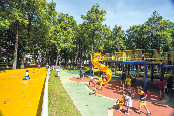
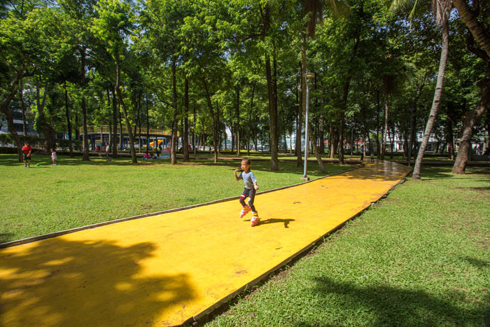
Located near Taman Puring Market, this park serves as a community space for recreation and relaxation while reinforcing Kebayoran Baru’s garden city concept. Photo by Des Syafrizal.
What sets Kebayoran Baru apart is its enduring relevance as a model for planned urban development in Indonesia, especially through its garden city concept. Parks such as Taman Puring, Taman Langsat, Taman Barito, Taman Ayodya, and Taman Leuser stand as important legacies of this early vision.
In the next phase of the area’s urban planning, three of its iconic parks, which are Taman Langsat, Taman Ayodya, and Taman Leuser, will be integrated into a unified green space known as Taman Bendera Pusaka in the Barito area. Scheduled for completion in 2026, Taman Bendera Pusaka will feature a connecting bridge to improve circulation and maximise the function of the entire park complex. The upgraded space will include a children’s playground, an amphitheater, a padel court, and a 1.2-kilometre jogging track for Jakarta residents and tourists to enjoy.
Acknowledgements
With great thanks to personal sources, Achmad Sofian and Reyhan Biadilla from Ngopi Jakarta, renowned storytellers of the city.